

Then you can see the tremendous trough digging into the South along the East Coast. Now look at the PNA (Top) and NAO (Bottom)
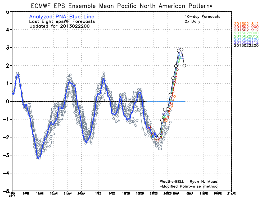

With the NAO tanking and the PNA shooting up this is prime for another East Coast storm! This is still 10 days out but the first week of March looks to be another stormy time period according to the NAO and PNA.
Right now the GFS at this time period points to a more positive tilt than a negative one so it's not showing much of a storm but it did the same thing with the Blizzard 10 days out. This time period bears watching for the next 5 days to see if the Operational models come around to what I am thinking. Stay tuned!!
No comments:
Post a Comment