According to the CPC this was their thinking as of February 21...

This is the most absurd thing I have ever seen. CFS 2-meter temp shows this...

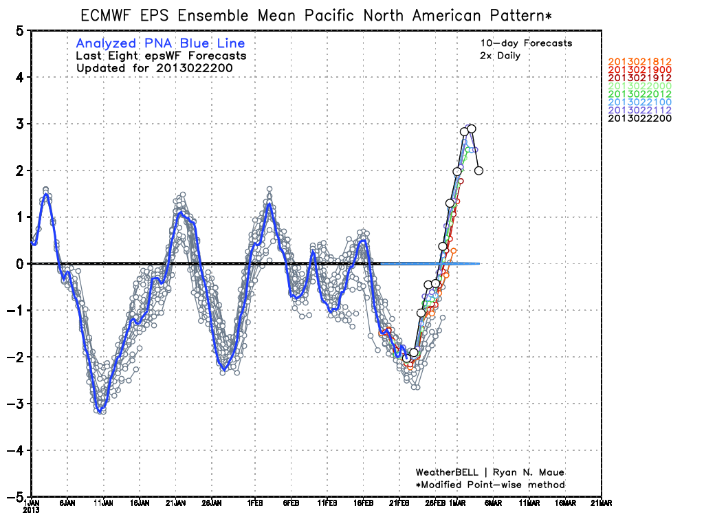
I think this is more in line as to what is going to happen. The beginning of March is going to be COLD over the Southeast. Florida will see temps almost 15 degrees below normal! For the first 10-12 days or so you will be hard pressed to see many temps above normal anywhere East of the Rockies. The second half of March looks to warm up a little over the East to near normal or slightly above but the extreme below normal temps for the first half will probably make March the 2nd straight month of Below average temps!!
As for any precip, a storm will be coming from the Northern Rockies Monday down to around Oklahoma and then sweeping East. The Northern side of the storm will be producing snow. The ECMWF has the snow North of Virginia. In my opinion I see this shifting further to the South and sweeping across Virginia. There are also hints on the Ensembles of more storms the first and second week of March with the most impressive being around March 12 and 13. This storm could be huge from the plains to virtually all of the East Coast. But that's liable to change 100 times between now and then just want you to be aware! I won't get all technical here because most won't have a clue what I'm talking about so this is what ya get!
Thank you for reading and stay tuned!!